×
Climate Adaptation and Resilience (CARE) for South Asia
All
Disasters
Climate
Water
Social
Economic
Environmental
Climate Engine
Flood Exposure
Standardized Precpitation Index
GEOSS Portal
Annual Precipitation
Flood Risk
Flood Frequency
Maritime Boundaries
NOAA Buoy Data Center
Sea Surface Temperature
Watershed Mapper
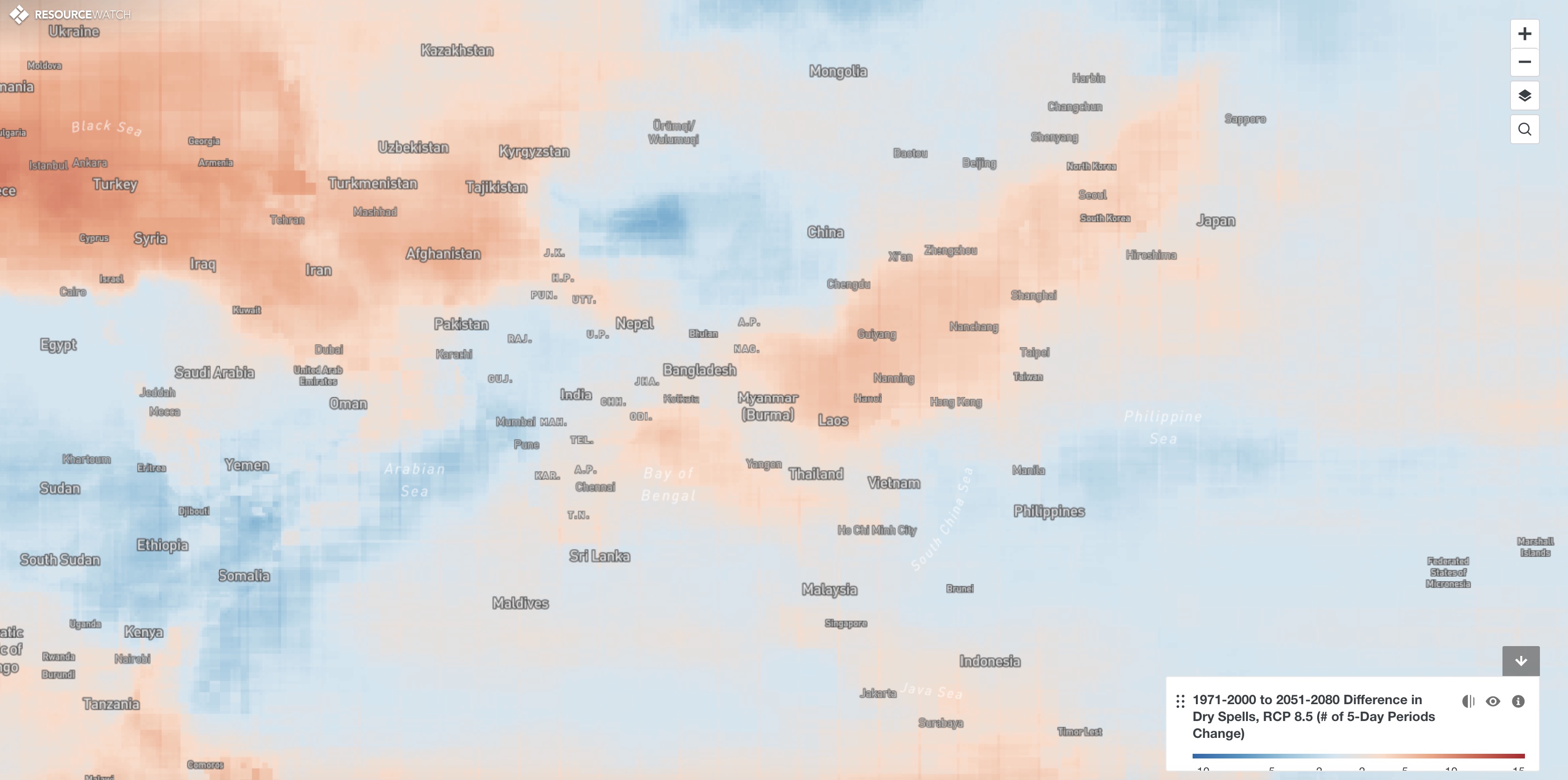
Projected Dry Spells
Drought Exposure
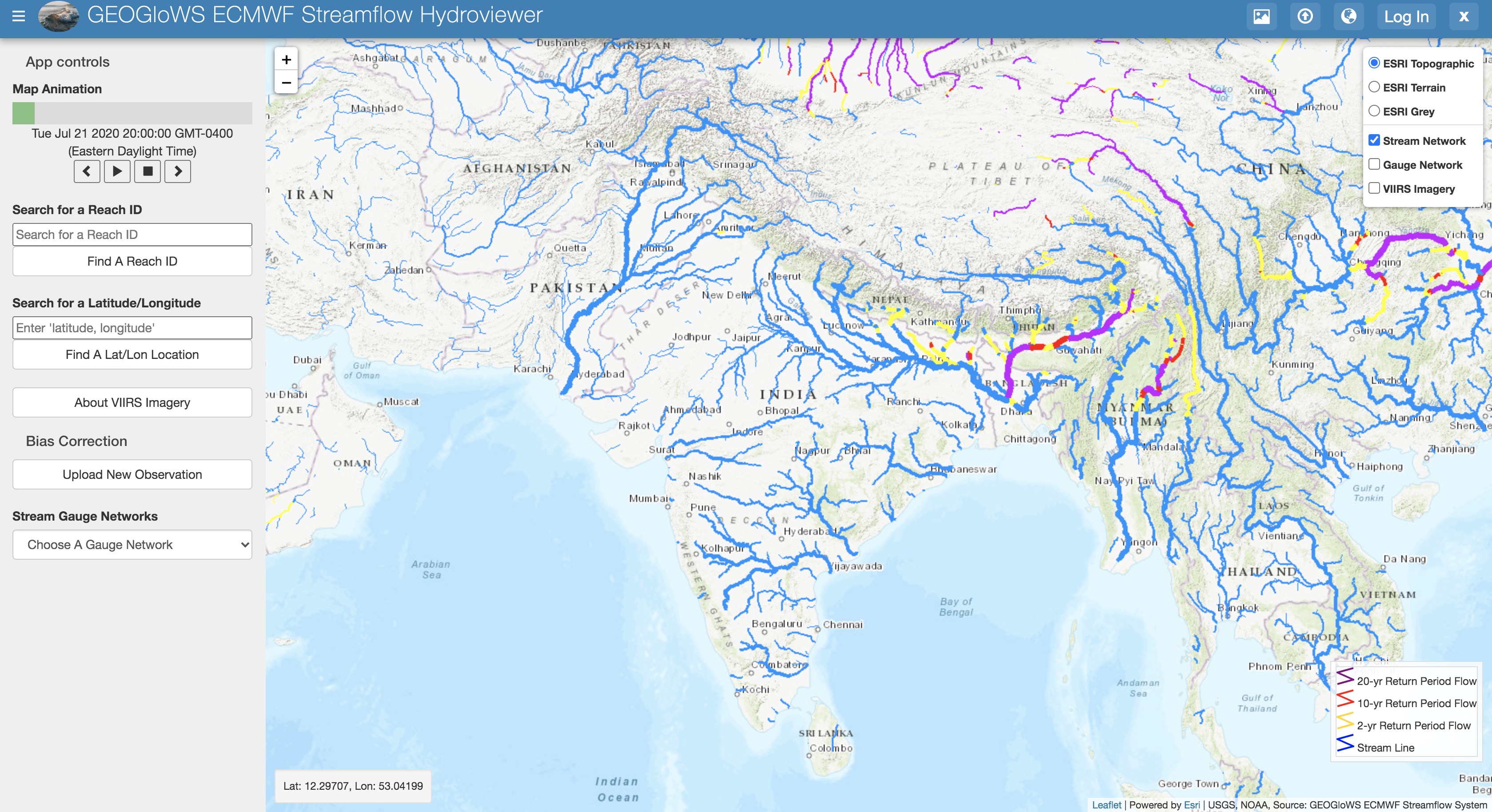
GEOGLOWS-ECMWF Streamflow Estimation
GRDC Stations
Water Security Dashboard
Google Earth Engine Datasets
Ocean Currents
SHRUG Atlas
Cities
JCP Bangladesh Meta Model
Total Precipitable Water
Satellite Precipitation (NASA)
Lake Levels
NASA WorldView
Precipitation (3 hour)
Global Urban Footprint
Himawari Animations
World Wind Map
MODIS Flood Explorer
MIT Trade Atlas
Climate Change Knowledge Portal
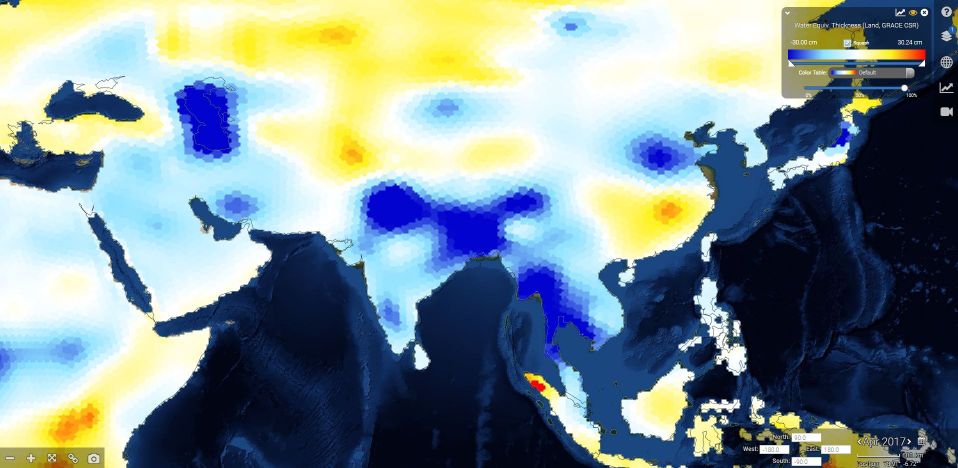
GRACE Groundwater Portal
GRACE Groundwater
Soil Moisture
Google Earth
Glacier Inventory
Fishing Watch
Seasonal Climate Forecasts
Hydropower Plants
GEOGLOWS Streamflow Estimator
Water Quality (Chlorophyll-A)
IWMI Water Data Portal
All Power Plants
GFMS
World Water Quality
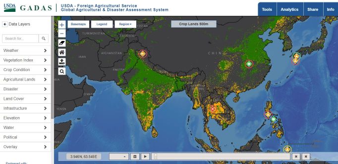
GADAS: Agriculture
Sea Surface Temperature
GDACS Tool
Surface Water Explorer
Cropping Extent
Crop Nutrient Balance
ESRI WATER Balance
City Water Intakes
Protected Areas
Snow Cover
Climate Stations
GDACS Floods
CIESIN Pop Grid
Landsat Archive
DFO App
Flood Observatory
NASA Disasters Portal
Major Ports
Servir Tethys Apps
Open Street Map Data
GEOGRLAM RAPP
Water Conflicts
Water Stress (Aqueduct)
Land-Water Changes
Tsunamis
Groundwater Climate Vulnerability
Population Density
Forest Cover Change
Erosion Risks
GRDC
Dams
Livestock Density
Open Data Cube


 from January 1, 1960, to December 31, 1990.")


 are areas within 200 nautical miles of the baselines from which the breadth of the territorial sea is measured.")


 in Koblenz, Germany.")


")


")
")


")


.")

 glacier data from the National Snow and Ice Data Center.")


 at 9 kilometer resolution for the previous month.")
, provides access to a large amount of data related to water and agriculture.")


.")


.")


")


 dataset for 2000-2018.")
 to 5 (High risk).")


