Many technologies can be deployed for better seascape management today including use of Earth Observation, Marine Spatial Planning, Bathymetry surveys, using Virtual Reality for sea-level rise scenarios or promoting more Open-Source Systems to improve the use of modern sensors, data, and analytics with the support of APIs to develop more collaborative systems, many in the public domain, including open-source hardware.
Key focus areas of Coastal Zone Management, Climate Adaptation, and Climate Mitigation are discussed in more detail below and different emerging technologies are playing a crucial role in these areas.
Coastal Zone Management
For a long time, coastal resilience was about building sea walls, elevating homes and renourishing beaches to protect people and property against storm surge. Then came satellites, the cloud and a new generation of tech entrepreneurs with bold ideas for tackling a new and urgent challenge: rapidly rising sea levels and increasingly destructive storms. As a result new technologies are emerging that facilitate more rapid acquisition of more accurate data and improve data visualization to support efforts to build coastal resilience. Coastal resilience is a top priority considering valuable natural resources and other assets are vulnerable to rising sea levels, escalating storm events and other environmental hazards.
In a 2020 review article , six sample case studies—Taiwan (Taiwan), Barcelona (Spain), Tokyo (Japan), Songdo (Korea), Rio de Janerio (Brazil), Orlando (USA)—were analyzed to identify what type of coastal disasters were tackled by cities using smart systems, at what stages of the disaster were they used (e.g., early warning, during disaster, disaster recovery etc.) and what smart features and systems were implemented in each city. Flooding (coastal and riverine), cyclone (typhoon, hurricane, tornado, and thunderstorm), tsunami, and landslide have been tacked by these cities. Early warning systems of these hazards were most benefited as information about these hazards were collected, analyzed and communicated to citizens for better preparation. For example, Tokyo's smart disaster early warning system covers a range of hazards, not just coastal, including earthquake. Technology vendor NEC has developed Tokyo's disaster resilience solution which includes observation systems, information gathering capabilities, data analysis and decision-making aids, together with an intelligent warning system, all linked together in an interoperable manner. Another example is from Rio de Janeiro, which has a central disaster coordination and operation center. Since opening, the Rio Operations Center has integrated information and processes from across 30 different city agencies into a single operations center that provides a holistic view of how the city is functioning on a 24 h basis. The Operations Center serves as the nerve center for the city, applying analytical models developed by IBM to more effectively predict and coordinate disaster management. Findings in this review article suggests, although smart city technologies such as internet of things (IoT) and crisis informatics have significant potential in coastal disaster management and have been increasingly used in academic studies but their city-scale applications have been rather limited. The paper identified critical gaps, R&D needs and practical challenges to foster development of smart city oriented decision support system for coastal disaster management.
Waterfront Development: Bounded by water, coastal and waterfront communities are challenged to make the best value of limited land while protecting critical natural resources from the potentially damaging effects of growth. Planning with smart growth principles can help communities make efficient investments in buildings and other infrastructure, protect and restore critical environmental areas, and protect public health. In applying these principles to any development project, communities need to explicitly consider natural hazards, including the potential impact of climate change. Resilience to natural hazards, such as storms and storm surges, sea-level rise, and shoreline erosion, is inextricably linked to the siting and design of development, as well as to the built and green infrastructure that supports it. Well-planned and well-maintained natural systems can help protect communities in many ways. For example, natural floodplains can act as protective buffers that absorb floodwater, reducing the speed and amount of flooding, controlling erosion, protecting drinking water supplies and water quality, and insulating buildings and roads from damage.
CORVI is a decision support tool for leaders who need to make smart climate investments to improve the safety and security of coastal cities. Currently operating in eight coastal cities around the world, CORVI organizes data and information across the land and seascape to provide decision makers with the complete risk picture they need to take action.
Coastal Erosion: Coastal ecosystems are being affected by loss of habitat, degradation, plastic pollution and natural hazards. Increasing sea level from climate change is changing the landscape of coasts, leading to more erosion of the coastlines, sea-level rise is also leading to flooding and leading to increase in underwater saltwater intrusion
The impact of climate change is also affecting coastal biodiversity, changing patterns and behavior of many marine species. Some species can adapt while others are disappearing such as coral from bleaching, as the algae they are dependent on are interrupted by rising temperatures. The increase in absorption of carbon dioxide is also causing ocean acidification, which has negatively impacted the lives of calcareous organisms.
Computer models can be used to simulate the behaviour at the actual coastal area using information about wind and waves, depth conditions and sediment types in that area.
Use of Earth Observation
Earth observation with in-situ surveys have been used to better understand and monitor many coastal zone assets such as Corals , mangroves , and other aspects of ocean wealth .
Scientists track sea surface temperature (SST) or SST changes since it affects weather, sea-level rise, and phytoplankton growth. The ocean covers more than 70 percent of the globe, and there is no way to measure the data without remote sensing. Remote sensing can only measure the top mm of the ocean's surface, so it is combined SST data from the buoy. Increasing SST by 2-3° C is an area of the Pacific Ocean that causes El Nino, affecting global rainfall patterns. Rising ocean temperatures increase the intensity of tropical cyclones (hurricanes and typhoons), and a factor of sea-level rise is from the thermal expansion of water. Lastly, phytoplankton growth, the basis for the ocean food web, is correlated with SST.
Scientists measure chlorophyll concentration since they provide information on plant abundance within a given area. Phytoplankton is a microscopic plant containing the pigment chlorophyll, which is used to convert sunlight into energy that the plant can use. Satellites detect chlorophyll concentrations since it reflects green and infrared light but absorb most spectrum of light. Phytoplankton abundance leads to blooms that occur every spring in the North Atlantic. However, it could also create harmful algal bloom or billions of phytoplankton die, and decaying over a few days will create oxygen dead zones that will kill fish and marine organisms.
Satellite-Derived Bathymetry is estimating underwater depths with the use of optical remote sensing. This method is used when ships cannot operate safely close to shore.
An alternative method to map seafloor bathymetry is to measure changes in gravity anomaly by measuring sea surface height accurately. Mountain and seafloor pull water toward their center of the mass that will create a little measurable bump on the surface, while a trench will create a dip.
Applications for Water Body Dynamics using Cloud Analytics also help us see how water bodies around the world wax and wane over time in response to inflows, outflows, use, and management (in the case of reservoirs or other regulated water bodies). Zoom into any part of the world and click on a water body to explore how its area has changed since 1985.
High frequency (HF) radar systems measure the speed and direction of surface ocean currents in near real-time as current data is used for water quality, tidal prediction, and search and rescue . HF radar can monitor a wide area from a few KM to about 200 KM offshore .
Hydrodynamic Modeling:
These tools explore flow in coasts, estuaries, and oceans with varying complexities
The ADCIRC (Advanced Circulation) is a free and open-source model that uses the shallow wave equation to simulate storm surges, tides, wind-driven circulation, and nearshore marine operations using the shallow wave equation. In addition, the model can be coupled with other models that allow for sediment transport and ice waves.
TELEMAC-2D is free and open-source software that is distributed by the TELEMAC-MASCARET consortium. The 2D depth average free surface hydrodynamic model uses the Saint Venant equation that computes water depth and the two velocity components. The model has been applied for maritime applications, including building dikes and dredging, flooding, and the impacts of waste discharges from coastal outfalls.
The TELEMAC-MASCARET consortium distributes TELEMAC-3D is a free and open-source model. The model simulates flow using the Navier Stokes equation with or without hydrostatic pressure (pressure from a confined space). This model has been applied to pollution, thermal dilution, sediment transport, and water quality.
MIKE 21 , developed by DHI, includes a flow model that solves the 2D shallow water equation using a depth-integrated average Navier Stokes equation in oceans and seas. The flow model is used for tidal hydraulics, storm surges, and the impact of wind and wave-generated current on offshore structures. Module add-ons include coastline morphology, which models coastal development, oil spills, and sand transport, which models sediment transport rates and has been utilized in shoreline protection, tidal inlet stability, and port layout optimization. Finally, the model includes several wave analyses that may be used to simulate port and coastal zones, wind-generated waves and swells, and how winds, waves, and currents will influence ships.
MIKE3 , developed by DHI, is a 3D hydrodynamic model that solves the full 3D Navier Stokes Equation or 3D shallow water equation. Hence, the model solves the continuity, momentum, temperature, salinity, and density equation using a turbulent closed boundary. MIKE3 can be applied to oceanographic, marine, and coastal applications. MIKE3 also incorporates additional add-on modules such as an underwater acoustic simulator for noise, mud transport for dredging operations, oil spill, and MIKE ECO LAB for water quality and ecological modeling.
Payment for ecosystem models aid in quantifying the benefit of natural resources provides and the value of protecting nature.
InVEST (Integrated Valuation of Ecosystem Services and Tradeoffs) is a collection of open-source software models that provide decision-makers with the tools to quantify and map the valuing of ecosystem services. The toolbox comprises ecosystem service models for terrestrial, freshwater, marine, and coastal ecosystems, including coastal blue carbon, coastal vulnerability, habitat risk assessment, and offshore wind and wave energy production.
Artificial Intelligence for Environment & Sustainability (ARIES) is an open-source modeling framework developed by the Basque Centre for Climate Change (BC3). ARIES uses AI and machine learning to automate data and model integration. A key component of ARIES is consistent semantics, which means a clearly defined description of the data and the model involved. ARIES for SEEA Explorer allows users to generate quick, standard, scalable, and customizable ecosystem accounts for their area of interest in line with the SEEA Ecosystem Accounting framework.
Earth observation and cloud computing offer an excellent opportunity to explore how coasts have shifted over time or account for climate change . Satellite imagery is beneficial for looking at and evaluating coastal change over time. Previously, this was challenging to do in the early days, but with free and commercial satellite imagery, it is becoming easier and performs analysis in the cloud where the results can be downloaded and not the imagery required to perform the analysis. This can be achieved with high-resolution imagery, such as Maxar Technologies or drone imagery. There is also open-source software using free imagery that could perform the processing in Google Earth Engine, which would be good enough where the shore has significantly eroded . Cloud computing, high-resolution imagery, and highly sophisticated computer programs also provide detailed information on coastal flooding from sea-level rise and coastal storms, and coastal changes to the shoreline.
More information on sea-level rise impact on coastal erosion is shown in the video below.
The Great Reef Census is a large-scale citizen science project to determine the health of the Great Barrier Reef from climate change. The first phase of the project began in 2020 when volunteers collected around 55,600 image s of the reef from tourism and dive boats with the intent to identify critical sources of coral larvae. The second phase of the project was to have citizens worldwide identify essential aspects of the reef, such as coral, sand, and debris. More information on the census is shown in the video below.
Scientists are using drones to collect snot data from the humpback whales' breath. Breath or snot provides research information on DNA, stress level, overall health, hormones, microbes, and germs within the respiratory tract, which are likely to cause sickness. More information on collection of snot from a blow hole is available from the video below.
3D Printed Reefs
To restore coral reef the fragile ecosystem, being destroyed by climate change and human activities and destroying marine life, scientists around the world are using 3D printing to print coral reefs on large scales, the coral carbonate used is similar to the original calcium carbonate, which is what forms the skeleton of original coral reefs. These structures encourage reef growth and help marine life to flourish. The 3D Printed reefs are more resistant to climate change and more durable in the changing chemistry of the ocean.
Marine Spatial Planning
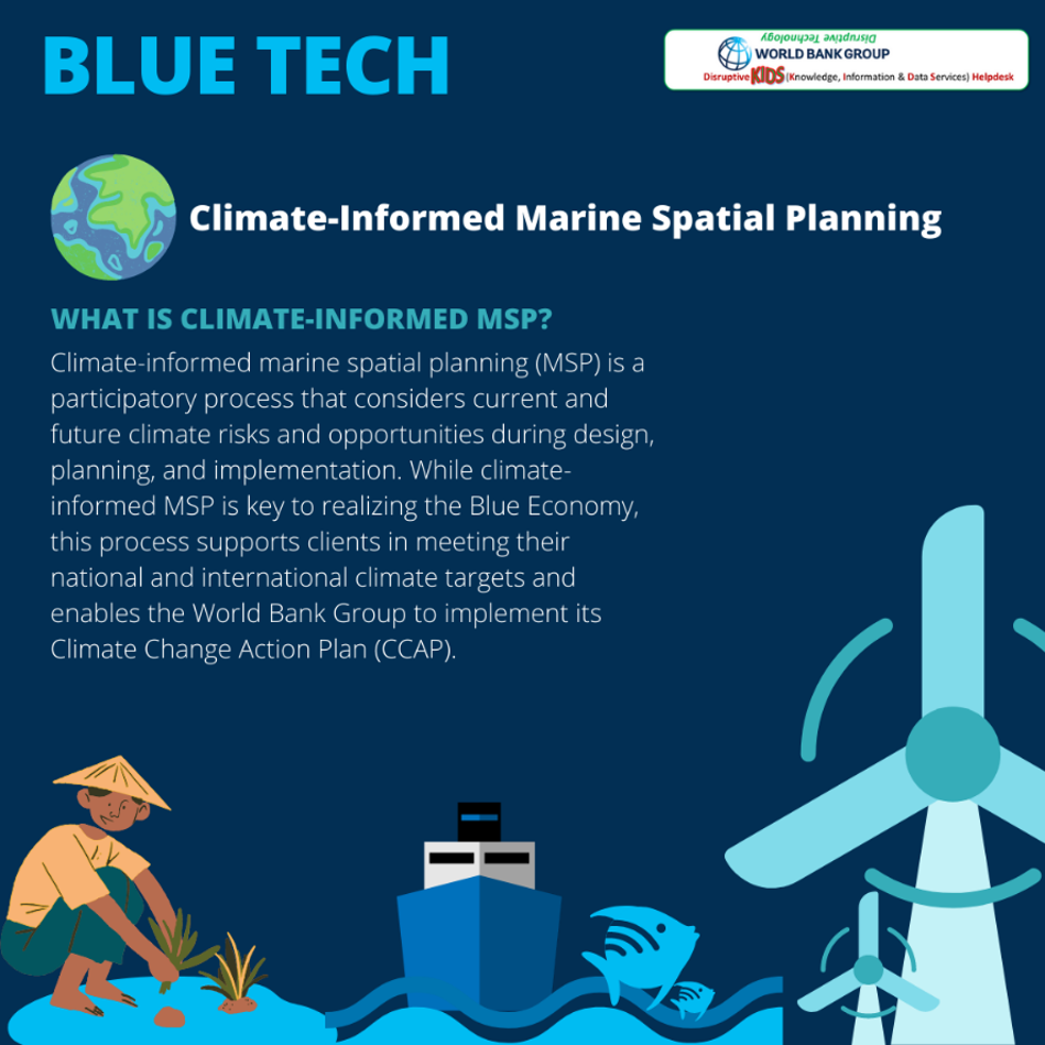
An example of seascape management is marine spatial planning. UNESCO defines “Marine Spatial Planning (MSP) as a process to analyze and allocate parts of 3-D marine spaces (or ecosystems) to specific uses or objectives, to achieve ecological, economic, and social objectives that are usually specified through a political process”. Various innovative ways are being adopted today for MSP, one of such examples is discussed below. Various innovative ways are being adopted today for MSP, one of such examples is discussed below.
Symphony, a planning tool is using an ecosystem approach to understand and illustrate how pressures from human activities are affecting ecological values. This scientific system is in use since 2017 in the Swedish national marine spatial planning and can be easily transferrable to other countries.
Australian researchers are determining the ideal location for incorporating seaweed as an effective biofilter in capturing and removing pollutants that can harm coral reefs. Nutrient runoff can cause an algal bloom that can diminish light and smother coral reefs, while ocean acidification from carbon dioxide decreases the skeleton density . Seaweed can absorb carbon, nitrogen, and phosphorus from the water, and seaweed can also provide marine habitat. In addition, seaweed biofilters have the potential to remove thousands of tons of dissolved inorganic nitrogen.
Drones for Mangrove Reforestation
To restore depleted mangrove forests, conservationists are deploying drones that can plant hundreds of thousands of trees per day to restore mangroves. The goal is to plant one billion trees across 350,000 hectares in the years ahead — and they are doing it in a way that empowers local communities. Using Artificial Intelligence, the drones map out the deforested areas and analyze the topography. Then they fire biodegradable pods into ideal locations for reforestation
Using Seagrass for carbon storage
Although seagrasses account for less than 0.2% of the world’s oceans, they sequester approximately 10% of the carbon buried in ocean sediment annually (27.4Tg of carbon per year). Per hectare, seagrasses can store up to twice as much carbon as terrestrial forests. The global seagrass ecosystem organic carbon pool could be as high as 19.9 billion metric tons.
Around the world, oysters are being used as one of many intervention practices in coastal zone management to reduce flooding by lowering the wave energy before it hits the shore. Oysters and mangroves lower the wave energy, which helps prevent coastal erosion. Outside of the natural environment and biodiversity gains from the introduction of oysters, each oyster can provide a water quality benefit since it filters 50 gallons of water per day.
Australian living seawall is improving the ecology in Sydney Harbour by converting the existing flat seawall into a living seawall by adding a hexagonal concrete panel that has depressions filled with kelp, seaweed, and barnacles. The living seawalls panels have 30-40% more species than on an unaltered section . One additional benefit of the living seawall is improved water quality from filter feeders such as oysters and barnacles. This technology is now being used in Wales and Singapore. More information is shown in the video below.
CoastSnap is a citizen science smartphone app that allows the public to monitor beach erosion. Tourists take a photo from a fixed location, a phone cradle on an observation deck, and post the image on the CoastSnap website. Researchers can generate a time-lapse photo displaying the shoreline position and beach width.
With coral bleaching occurring worldwide, scientists are looking for methods to grow coral quickly. Under natural processes, coral takes 25 years to reproduce ; however, scientists discovered a procedure for coral to grow within 2 - 5 years by using micro-fragmentation and coral reskinning. Micro-fragmentation is cutting coral into smaller pieces, allowing coral tissue growth 25 to 50 times faster than the expected growth rate . Reskinning allows certain coral polyps growing near each other to grow back as one at a rate of up to tenfold.
Unmanned Vessels for Ocean Data Collection
Information that can protect at-risk whale species, allow ships to voyage more fuel-efficient routes, crack down on illegal fishing, and enable us to better understand the impacts of climate change. A Canadian company is deploying USVs (Uncrewed or Unmanned Surface Vehicles) are equipped with sensors, cameras, and communication devices so that can capture information from anywhere on the ocean and have instant access to it. Running on solar energy, the boats travel nonstop for months, without producing any greenhouse gas emissions, noise pollution or risk of oil spills. USVs are an essential component to creating a digital ocean, an Internet of Things for the sea, where finally stakeholders can begin to understand fully the oceans and elements within the oceans. Another company has developed an unmanned autonomous vehicle that can operate in harsh environments for an extended time. The drones have been deployed to monitor ice melting in the Arctic, measure ocean salinity, count marine species, and collect information from hurricanes .
Researching the twilight zone twilight zone's for biodiversity and carbon sequestration requires a different type of vehicle. Researchers developed an explorer that incorporates cameras and unique light to watch animals without light or sound disturbance. Ambient DNA from the ocean is filtered for seawater before testing.
Bathymetry surveys allow us to map different underwater features of a water body. Multiple ways can be used to conduct bathymetry surveys including multi-beam surveying, single-beam surveying, ADCP (Acoustic Doppler Current Profiler), through use of autonomous underwater vehicles, or airborne drones
EcoMapper AUV (autonomous underwater vehicle) collects high-resolution maps of water quality and bathymetry. Key applications of the AUV include baseline monitoring, source water mapping, event response, bottom mapping, and point-source as well as non-point source mapping.
UGCS airborne bathymetry survey uses a UAV (Unmanned Arial Vehicle) drone equipped with echo sounder to acquire bathymetry data of coastal and inland water, enabling data collection even in hard-to-reach areas.
Satellite Observation for Ocean Data Collection
For the past four decades, altimetry satellite instruments have monitored global sea-level rise and ocean topography. Five satellites have been launched to measure tide gauge, which began in 1992 and use similar instruments and the same orbit every ten days. Altimetry data provides about half a million virtual tide gauges, while only 1,500 tide gauges have been compiled and analyzed. Data from physical tide gauges are used to corroborate satellite observations. The satellite observation from 1993 to 2018, shown in the image below, reveals significant spatial variations compared to the global rate. The results show that the average sea level rise has increased from 3.4 mm (about 0.13 in)/year to 2.5 mm (about 0.1 in)/year.
Source: NASA
The impact of sea-level rise is that every increase of 25 mm will lead to 2.5 meters of beach loss. More information on satellite altimetry and sea-level rise is shown in the video below.
The Allen Coral Atlas is a real-time, satellite-based global coral habitat and monitoring system for shallow coral reefs. Imagery data were developed from high-resolution imagery data and machine learning from survey reference data. The output data from the map provides detailed information on composition and structure and information on coral bleaching, and sea surface temperature. More information in the atlas is shown in the video below.
Restoring Beaches through Sustainable Coastal Protection and Management
The coastal town of Ullal in the state of Karnataka is an important trading center in the southwestern region of India. However, the safety and livelihood of its communities are threatened by shoreline erosion. The introduction of environmentally appropriate hybrid solutions, by the ADB, has helped counter this threat to ensure sustainable coastal protection and climate change-resilient infrastructure. This is a solution that can be replicated to other communities and countries.
An underwater drone has been specifically designed to monitor coral reefs' health for the Great Barrier Reef using a computer tablet. Using computer vision, the drone, called Range rBot, can avoid obstructions and monitor coral bleaching, water quality pest species, pollution and siltation . In addition, RangerBot can monitor a large area since it can stay underwater three times longer than a diver and work in any environment. Lastly, the underwater drone can detect dangerous species to the coral reef and inject a toxin that will kill the species and yet leave the reef unharmed.
Australian researchers are trying to prevent coral bleaching of the Great Barrier Reef by modifying the clouds by making them brighter during a heatwave. Ocean water is pumped and atomized, and water droplets will brighten the clouds and reduce the amount of light falling on the reef. Light reduction by 6 percent could minimize 50-60 percent heat stress . More information is shown in the video below.
Globally, there are over 12,000 offshore oil and gas platforms. Over time, the oil and gas will dry up, where oil companies will have to determine whether they would have to remove the or reef the platform. Removing the rig is labor intensive while allowing the rigs to corrode is an environmental concern to the marine environment. However, the subsurface rig provides an appropriate skeleton for the coral reef and can be the most productive rig in the world. Rigs are sometimes better nurseries than natural reefs due to the vertical structure of the rig. Platform allows fish to move in deeper water without leaving their environment.
The Museum of Underwater Sculpture is a tourist attraction for divers and snorkelers. It has 93 sculptures located on the seabed, 8 to 10 meters underwater and away from the shore. Each sculpture displayed an environmental theme and was carved out of inert ph-neutral material that should attract marine life over time.
Managing seascapes often requires a perspective of looking inland to explore challenges and opportunities in upstream watersheds (e.g.,, which are the major source of pollution/plastics even in beach and ocean areas).
Climate Adaptation
Coastal Flood/Resilience Interactive Geospatial Platforms
A number of interactive geospatial platforms and portals that help visualize and access coastal flood and coastal resilience related data and information are publicly available at no cost. Some of these are presented here for illustration. These types of platforms and online services are expected to keep evolving in the future leveraging improvements in earth observation and open access data.
Five case studies—Vanuatu (South Pacific Ocean), Chennai (India), Mexican State (USA), Japan, Colombia—are presented in an ITU (International Telecommunication Union) document to take a closer look at the application of disruptive technologies to support disaster management in coastal communities, with the following findings:
§ In Vanuatu, aerial drones were used following Cyclone Pam for disaster assessment. Drones were felt to be an ideal solution for rapid and granular evaluation of the situation, particularly since cloud cover obscured satellite images. The imagery showed which houses were unrepairable compared with those that could be fixed, helping to guide funding and recovery efforts. Crops were surveyed for damage in order to determine how much food people would need from other sources. The imagery was input to an open source mapping platform for volunteers to upload and geo-tag images from social media to overlay on the map. There were challenges with connectivity, the weather conditions and data formats. Nevertheless, the experience provided valuable insights, with the drones providing the fastest method of mapping the damaged areas.
§ Twitter was deployed by a number of different groups for a variety of purposes following severe flooding in Chennai in 2015. Although emergency telephone numbers were established, they were overloaded, making social media such as Twitter a popular method for communication for those with Internet access. The Twitter live, real-time public platform was used by nongovernmental organizations (NGOs), the public, government agencies and the media to share and exchange information. This resulted in unprecedented collaboration on the platform in responding to the crisis. Twitter India publicized three hashtags to be used during the flood, depending on the nature of the tweet, for citizen groups to help agencies on the ground. A variety of information was shared, including helpline phone numbers, updated train schedules, weather forecasts, relief efforts and safety tips. This helped to magnify critical messages, organize relief efforts, assist government agencies, warn the public and provide information in real time to citizens trapped in the floods.
§ Researchers used Big Data techniques to explore financial transactions before, during and after Hurricane Odile struck the Mexican State of Baja California Sur in September 2014, to analyze its economic impact on those affected. The analysis identified which groups were most affected for targeting post-disaster assistance and how long it took to return to normal, and generated estimates of the economic impact.
§ Japan is a pioneering center for the use of robots in disasters. The Human–Robot Informatics Laboratory of Tohoku University has developed several types of robots for disaster response, including a snake-like robot with a camera that can crawl over obstacles, follow walls, and make turns in tight spaces. Research is ongoing to augment search-and-rescue dogs using cameras, Global Positioning System (GPS) and inertial measurement units, which are being designed to be small and light to fit on a dog pack. Damage to the Fukushima Daiichi Nuclear Power Plant in the 2011 earthquake triggered significant robot research due to radiation preventing humans from carrying out direct cleanup activities. One of the biggest challenges has been determining what happened to the fuel inside the core of the reactor. Various robots were used to penetrate the core, but without success. Finally, in 2017, a small robot designed to operate underwater with severe radiation exposure succeeded in locating the missing fuel inside the reactor core. Japanese manufacturer Honda is developing a disaster response robot that can walk, scale obstacles and climb ladders. If the prototype reaches fruition, it could have a major impact for rescue operations and clearing hazardous materials.
§ Following the flooding of the Liboriana River , which triggered a devastating landslide in May 2015, causing more than 80 deaths, the Government of Colombia’s National Unit for Disaster Risk Management took steps to mitigate future occurrences. It hired a company to implement an early warning system using IoT technology. Five solar powered sensors were installed along the Liboriana and two other rivers to monitor water levels and air temperature using ultrasound. The use of solar ensures the sensors continue to function in the event of an electricity outage. The system automatically sends a text message to village authorities if a risk is detected, and data are also stored in the cloud for others to access.
Virtual Reality for Sea-Level Rise Scenarios
There are many tools to explore sea-level rise scenarios in your neighborhood (e.g. in the US or globally ). These can become much more interactive using new technologies such as Virtual Reality. Virtual Reality is a computer-generated immersive environment, an artificial scenario that creates an alternative environment making the user feel they are in a different place. This can be particularly useful for education purposes to show to the public the impacts of climate change. One useful application is to recreate the changes a coastal community could face if they were affected by sea-level rise.
It is accepted that the global mean sea level is likely to rise 20-30 centimeters by 2050 . End of the century projections are even worse. Those incorporating Antarctic ice sheet dynamics reveal estimates ranging from 70-100 cm under representative concentration pathway (a greenhouse gas concentration trajectory adopted by the Intergovernmental Panel on Climate Change) RCP 4.5 and 100-180 cm under RCP 8.5.
Virtual Planet is a company that explores climate impacts through visualization based on hyper realistic models. They have leveraged the capabilities of drones, 3D mapping and virtual reality technology to recreate different coastal and inland hazards and help communities to learn about potential challenges and to adapt to a new climate. They use drones to get photos and specific information about the area that they are going to study. Then they combine that information with local elevation data, flood information and sea level rise projections to make site-specific renderings for what each place should expect to see with rising seas.
Climate Mitigation
Blue Carbon
Blue Carbon is an increasingly important concept to recognize that planting seaweed, mangroves, and other such vegetation can help sequester large amounts of carbon (often exceeding those from terrestrial forests on a per hectare basis), while often also providing climate mitigation benefits from coastal storms.
Building coastal resilience through innovative tools with better data and metrics are needed to identify what programs work and why, quantifying the results and outcomes across environment and livelihoods. The Commonwealth Marine Economies Program is supporting Caribbean and Pacific Small Island Developing States to preserve their marine environment along the lines of innovation.
Blue Ventures works with coastal communities at over 120 sites globally. Their aim is to transform the blue carbon market by putting carbon accounting into the hands of coastal communities at scale. Their team is developing The Google Earth Engine Mangrove Mapping Methodology (GEM) as an accessible, cloud-based tool that supports rapid monitoring of mangrove cover and historical change by non-specialists. This simple (non-coding) interface will remove key barriers to communities developing mangrove blue carbon projects. Validation, GEM will be freely available online to non-profit users.’ Here are the 12 Top Innovators working to increase the supply of high-quality blue carbon projects and credits: Distant Imagery , Friendship Bangladesh , Africa Conservation Initiative , Kelp Forest Foundation , The Ocean Foundation , Mikoko Pamoja Community Based Organization , Yayasan IKAMaT: Mangrove Tag , Reforest’ Action together with Yagasu, Blue Ventures , Silvestrum Climate Associate , The Nature Conservancy in Latin America , Distributed Addictive Manufacturing .
Automated Harvesting and Replanting of Seaweed
An automated catamaran is capable of harvesting and replanting seaweed. The machine loops back and forth between seaweed lines, removing mature plants and replacing them with newly seeded lines.