Prioritizing Investments for Sediment Management: An Overview
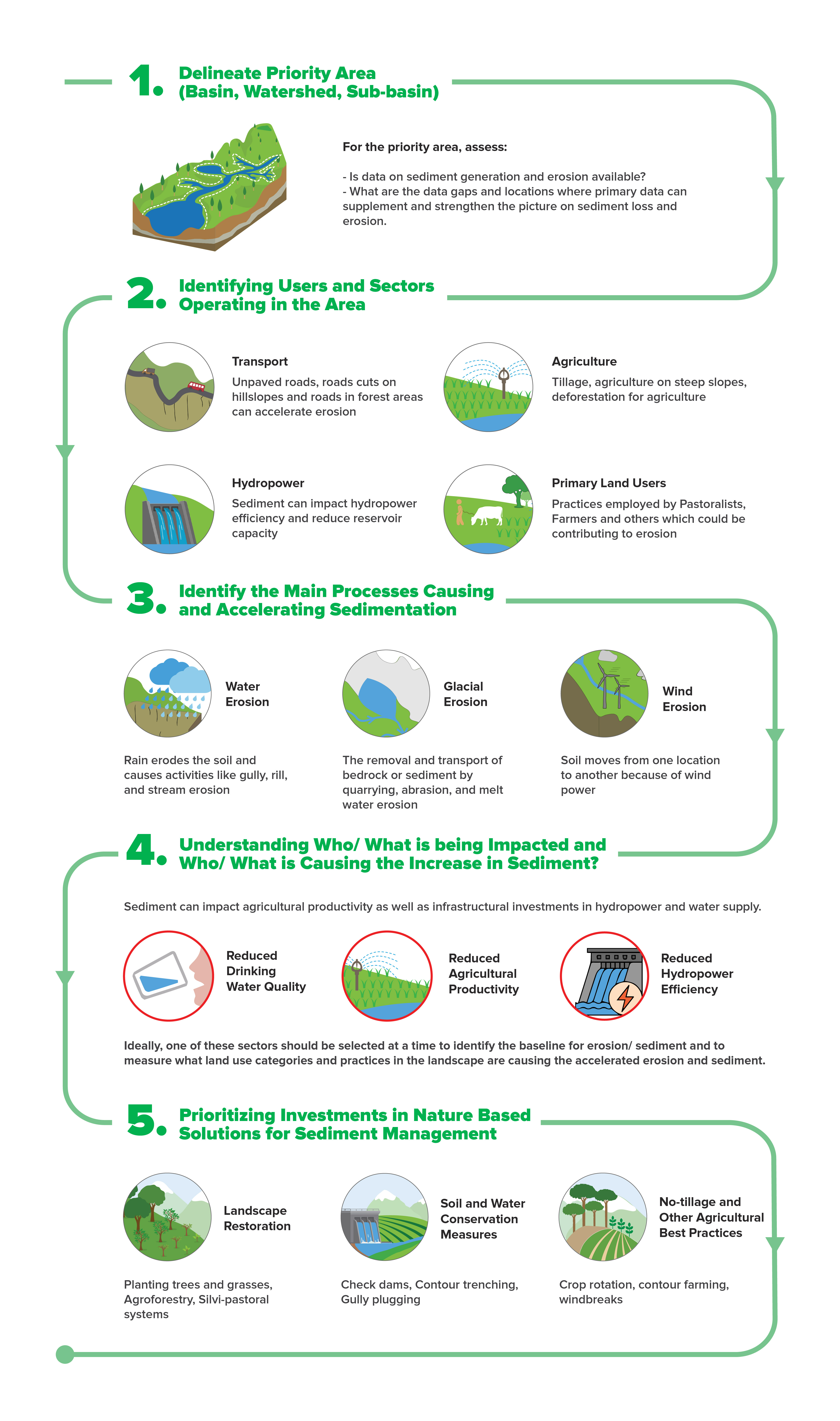
Erosion and Sediment: Why measure and manage it?
Erosion and sedimentation are an integral part of the natural geological and biogeochemical cycles of the earth and that play a key role in maintaining a landscape and its associated habitats and ecosystems. However, accelerated rates of erosion and sedimentation, caused by a combination of natural and anthropogenic factors can have detrimental impacts on livelihoods and infrastructure and lead to economic losses.
Human activities, such as forest clearance, intensive agriculture, the construction of roads and water resource development such as dams and irrigation systems, have an impact on erosion rates and sediment transfer from the land to rivers and oceans. Planning land-use activities to minimize their impacts on rates of erosion and sedimentation can have valuable benefits.
Identifying the hotspots of erosion and sediment are the first step to addressing the challenges they pose. Modelling erosion and sedimentation can help in integrated planning and landscape approaches. They can also help plan optimum locations for infrastructure such as roads, reservoirs and water supply schemes.
Managing erosion and sediment through nature based solutions such as afforestation, soil and water conservation measures and improved agricultural practices can reduce risks and economic losses to costly infrastructure while also improving livelihoods and resilience in the landscape.
Global Soil Erosion Map
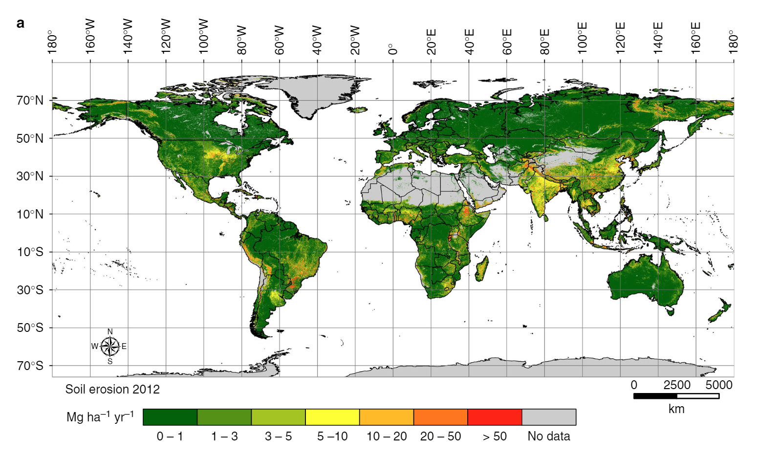
Source: https://rdcu.be/b8i6Y (Borelli, P. et al., 2017) High resolution (250 × 250 m) global potential soil erosion model, using a combination of remote sensing, GIS modelling and census data. The total soil loss, globally has been estimated to 35 Pg (Billion tonnes) yr-1 of soil eroded in 2001 with an area-specific soil erosion average of 2.8 Mg (Milligram) ha-1 yr-1.
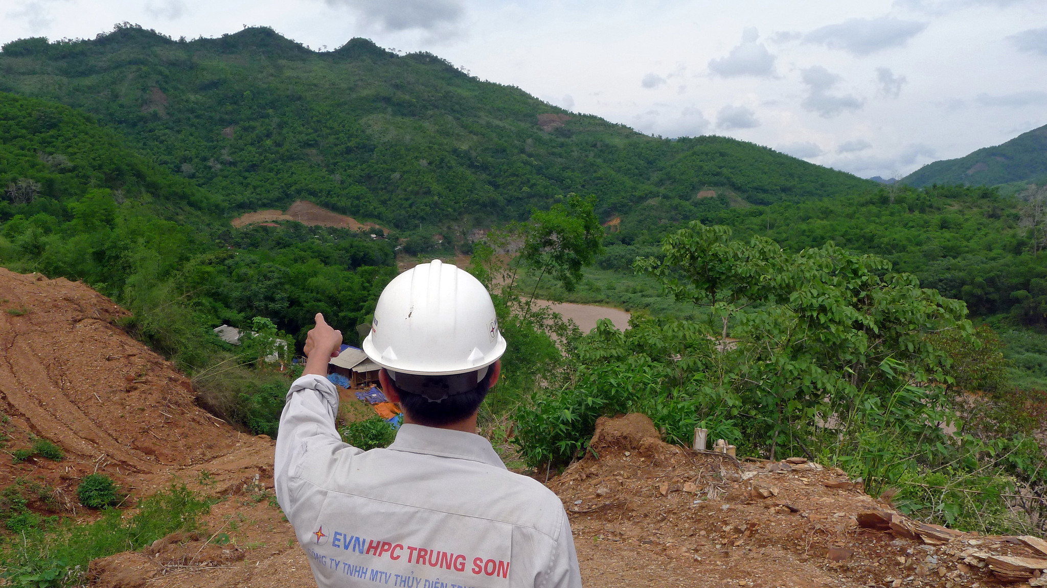
Managing sediment
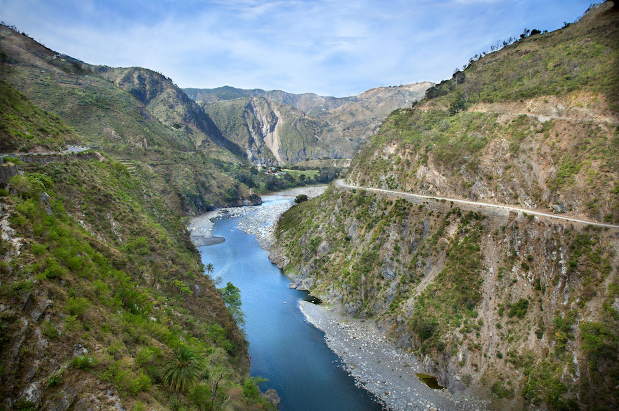
Accelerated erosion in the Himalayas