Topography
The Arabian Peninsula is a solid massif of rock; geologic influences pushed the eastern part of the mass downward and the western and southern extents upwards. For this reason, Saudi Arabia has lower elevations to the east along the Red Sea, and higher elevations to the west, with the highest elevations located in the southwest of the country. Central Saudi Arabia is marked by the plateau of Najd; the 500 mile-long Ṭuwaiq escarpment south of Riyadh is located within the plateau, with wadis on either side, including the Wadi Hanifa.
Land
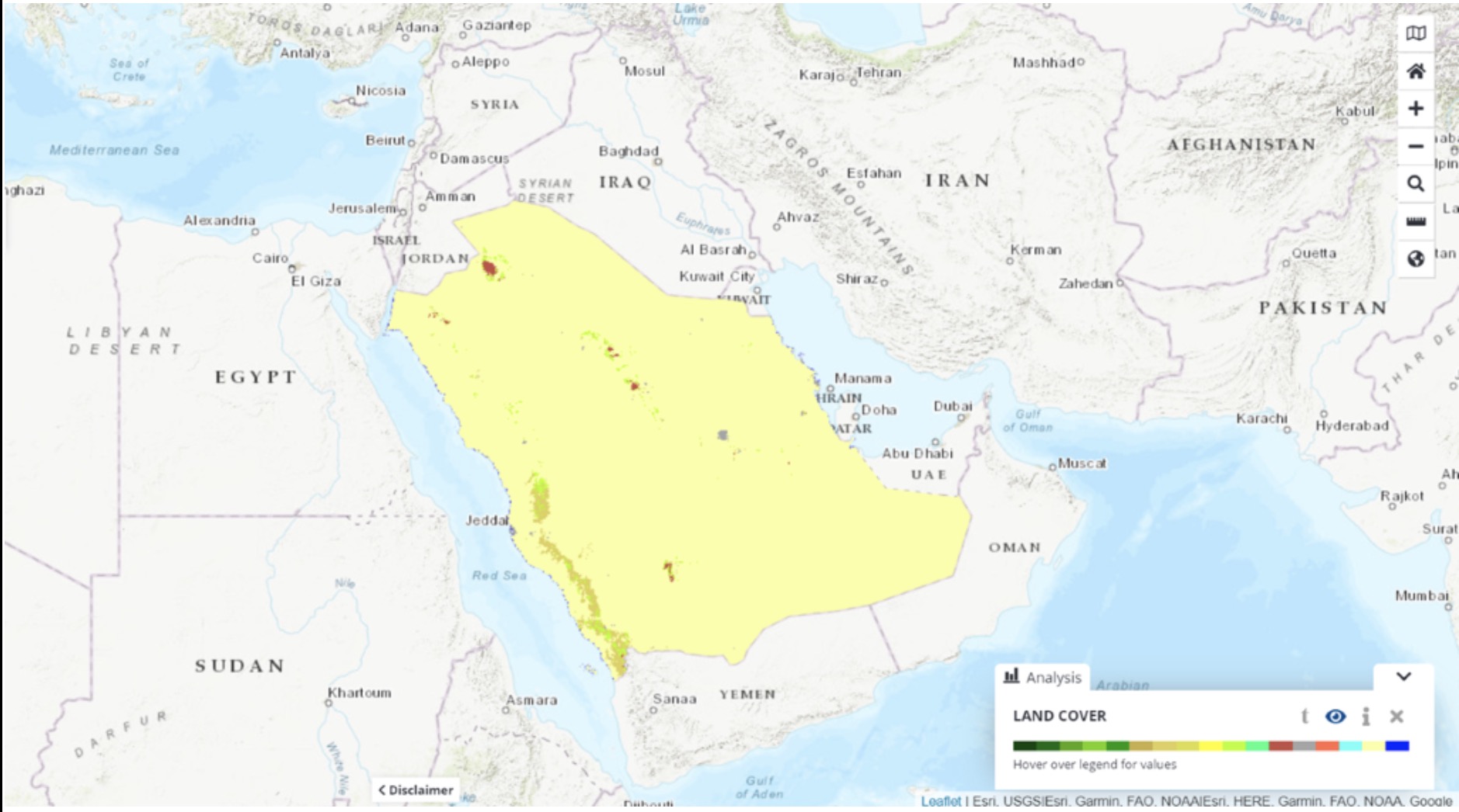
Saudi Arabia’s land base is comprised almost entirely of dry desert. Intermittent wadis are also a feature of the landscape, but permanent surface water resources are almost nonexistent. The country has almost no permanent streams but does have extensive wadi areas, as well as salt flats and marshes on the coastline of the Gulf. To the south, the Rub al-Khali (“Empty Quarter”) is the largest sand area in the world, covering more than 250,000 square miles.
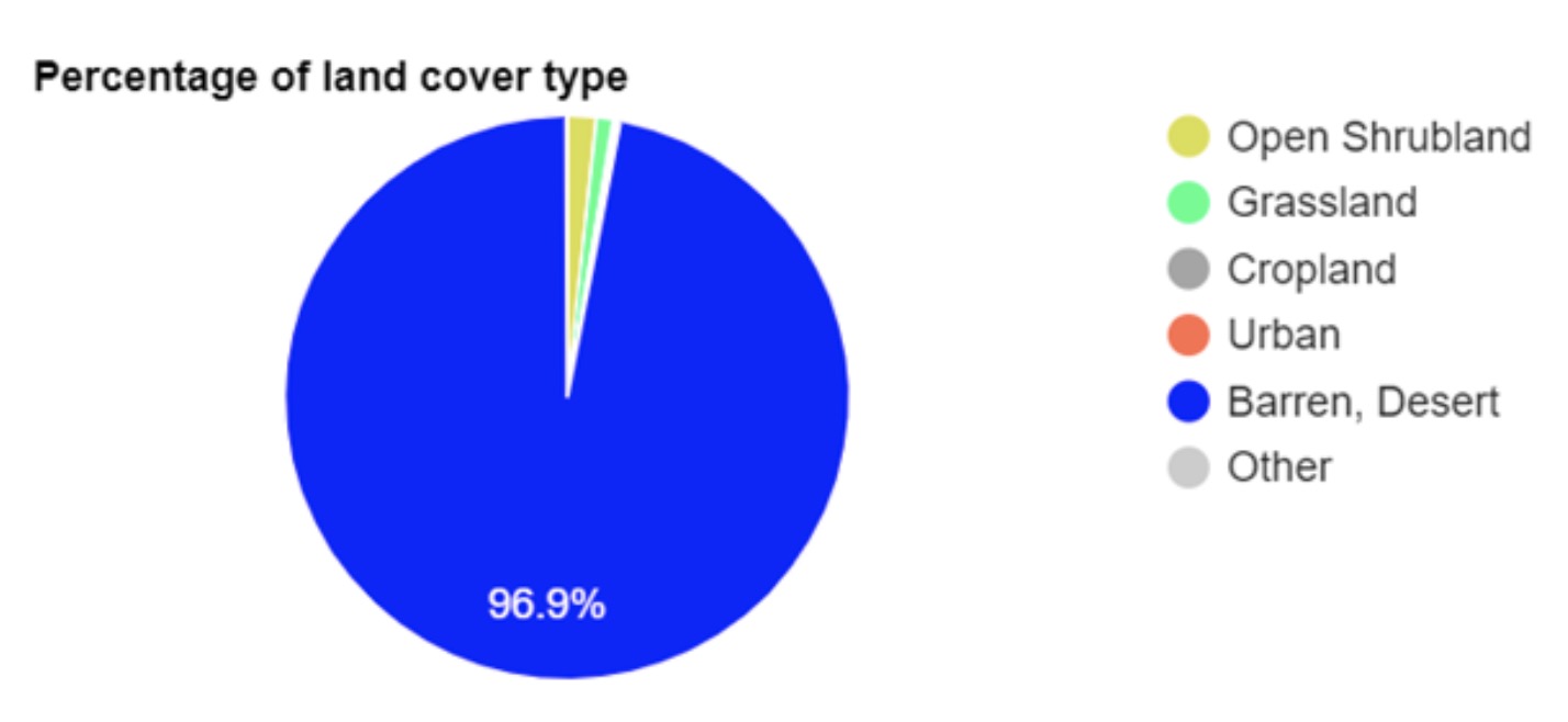
The majority of Saudi Arabia’s land is in agricultural use (over 80%) with nearly all of this categorized as permanent pasture. The country has a very small amount of forest, accounting for just 0.5% of the land area. Cropped areas do not comprise a large proportion of Saudi Arabia’s land area; less than 2% of the land is used for crop cultivation. In the cultivated areas, half of the cropped area is rain-fed. Most irrigated areas use groundwater. While Saudi Arabia grows some of its own crops (notably wheat and some fruits), the country still needs to import much of its food supply. Livestock density is relatively low across most of the country.