Burundi, a small landlocked country known as the land of three thousand hills, is one of the five poorest countries in the world and the second-most densely populated in Africa. 83.4% of its 11.6 million population (or 9.7 million people) are currently living below the poverty line (2019 estimates). Burundi has a long history of fragility and poverty, having suffered a decade of conflict between 1993-2003, which has left its civil population destitute and resource-dependent. Climate change exacerbates poverty and fragility in Burundi. These colline landscapes are home to over 90% of the country’s largely rural population (majority women and youth) dependent on climate-sensitive sectors such as agriculture, water resources, and forestry for their livelihoods.
In 2018, the World Bank initiated landscape approach interventions in Burundi through (a) the Burundi Landscape Restoration and Resilience Project ($30M, P160613, 2018-2023) covering 22 hills; and (b) GEF additional financing from FOLUR ($6M, P171745, 2021-2023) extending landscape restoration and community resilience activities from the parent project to 9 hills in Kayanza Province. Put together; the two projects are to cover only a total of 31 collines by 2023. There is a need for scaling up landscape restoration and climate resilience activities to the remaining 2,608 collines of Burundi.
A new World Bank-executed Advisory Services and Analytics (ASA) project aiming to diagnose drivers of climate and environmental fragility in Burundi (hereafter referred to as the Burundi Climate & Fragility ASA), will inform the pathway for such scaling up across all of Burundi’s collines, and make the case for mobilizing investment at scale for landscape restoration and climate resilience in Burundi. This work is funded by the PROGREEN Trust Fund. The Burundi climate & fragility ASA has three main components, as summarized in figure 1 below.
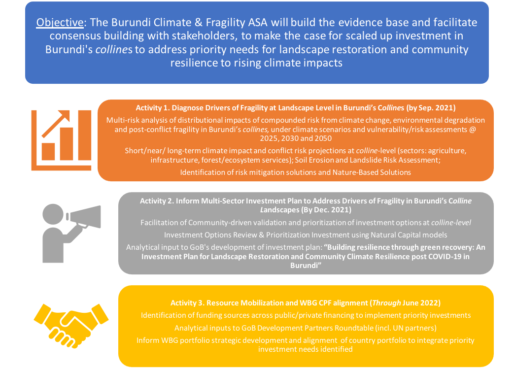
Figure 1. - Project Components
In support of the Burundi Climate & Fragility ASA’s activity #1, “Diagnosing Drivers of Fragility at Landscape Level in Burundi’ Collines,” two global consultancy firms (Red Cross Red Crescent Climate Centre and Stanford University Natural Capital Project) were hired to lead the climate, fragility and multi-risk impact assessment for the ASA. One firm (Climate Centre et al.)1 focused on climate risk impact assessment (multiple hazards). The second firm (Stanford Natural Capital Project) focused on ecosystem-based landscape risk assessment (landslide and soil erosion). The joint analyses result in a national multi-risk and vulnerability hotspot mapping at colline-level with the overall goal to inform climate resilience investment development planning (see project timeline, Figure 2). In the format of an e-book, this final report is an interactive digital platform integrating the Burundi ASA findings with additional visual evidence of the climate risk impacts, including videos, photos, and other news stories. In addition, it allows users to watch, zoom in, and interact with some pop-up values associated with the map outputs. More importantly, the e-book serves as a synthesis of the key findings from the analysis of Burundi’s key climate, environmental, and fragility risks threatening the resilience of people, livelihoods, and assets on Burundi’s colline landscapes. Other vital tools to accompany this report include a story map of multi-risk hotspot maps and an online knowledge platform.
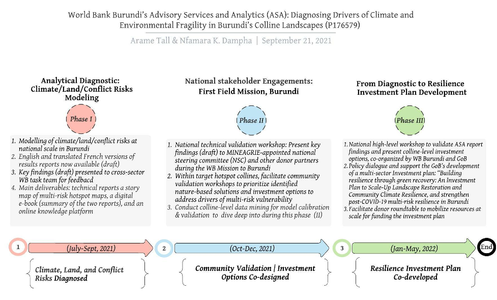
Figure 2. - Timeline of deliverables Burundi climate and fragility ASA